Secure the World.


Simulation and gaming
in the digital globe
The popular availability of free, open-source, or COTS web-based geospatial visualization tools like Google Earth, Microsoft Virtual Earth, and WebGL Earth have given us an incredibly enormous and detailed stage... just begging for actors.
By dynamically animating track actors in the digital globe, our simulation and gaming platform provides a lightweight, practical tool for producing interactive geospatial event simulations for a wide variety of applications, including situational awareness, planning, training, education, or video games.
![]()
Note: The Google Earth API has been deprecated by Google and is no longer supported, rendering Geoception no longer playable as of 2017. See here for more details. |
|
geo- (earth); -cept (to take, to seize) |
The Geoception International Tactical Robot Operator Network (InterTRON)
It is the near future, and Geoception, Inc is the world's leader in unmanned security systems. Using networks of combat drones in place of mercenaries, they have revolutionized private security contracting. Cities and nations, one by one, begin to see the cheap, efficient robotic policing services they provide as a God-send in hard economic times... in some cases, entirely removing the need for any human police in the city.
With precision and efficiency, you must play the role of security drone operator in this reality-based game environment -- engaging the enemy, destroying targets, neutralizing hostiles, and "spreading the peace"... until it covers the entire world.
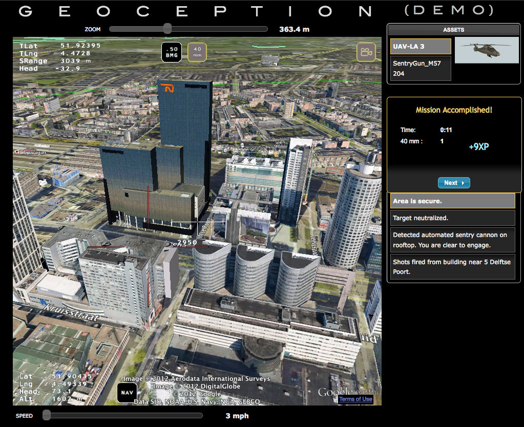
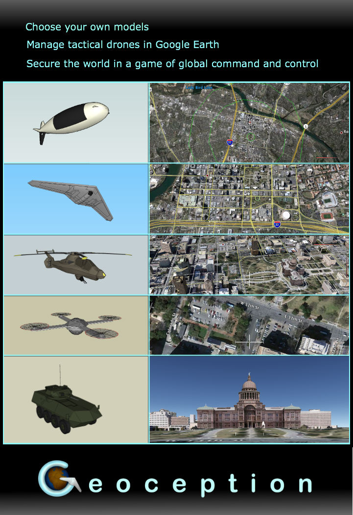
Screenshots